

The Georgia Loop Day 1: Walking with Ghosts
Field Notes III.XV: Backpacking and photographing the 60 mile Georgia Loop

Welcome to Field Notes!
Read some of the background and logistics of this trail HERE
*Where some images appear in a square gallery format, try clicking each one to see the full photo.

After the time change in early March, followed by the spring equinox, daylight lasted much later into the evening. It was 6 pm on my day off, and still not quite dusk outside. The chicken was done. I pulled the baking dish from the oven and set it on the stove top to cool. My wife and daughter pulled into the carport after a late day at school. We would have to wait to eat dinner though, as my daughter had a short turn around time to get to volleyball practice.
Suddenly my phone erupted with alarm. A murder suspect barricaded in a house. I had to go to work.
I deployed with the entry team. The location was a nice suburban home with a well maintained yard. The body lay partially wrapped in a blue tarp just before the front porch. I knew the man. We’d spoken on a number of occasions.
No contact had been made with the adult son since he ran back inside the house. A window was breached to gain access and eventually he was discovered by an interior drone. He appeared to be deceased from a self inflicted gunshot.
The team still had to clear the building as if there was an active threat inside. You’re never certain until you are certain. The son’s body lay at the base of a narrow stairway leading to a small room in the basement. There was a pool of blood under his head, maroon and partly congealed. The pistol lay beside him. His skin still felt warm as I placed my fingers on the side of his neck. No pulse. I had known this man, too.
The team pulled back to the command post. We de-briefed the incident under radiant orange clouds in the sunset sky. And then I went home.

A few days later I am cancelling my plans to thru hike the Bartram Trail. This is the same route I cancelled last fall, just 2 days before Hurricane Helene wrought destruction across Southern Appalachia.
This time it’s a wildfire. Named the Big Ridge Fire, it is spreading uncontrolled in the Warwoman WMA and has a stretch of the Bartram Trail closed to all visitors.
One day I will hike that trail, but for now I must find an alternate plan. The one I find is informally called The Georgia Loop. It follows the Duncan Ridge Trail in the Chattahoochee-Oconee National Forest, merging with the Benton MacKaye Trail for part of the way, to connect two points on the Appalachian Trail.
The Georgia Loop is a 60 mile route that I plan to complete in 4 days. The Duncan Ridge is described as the toughest stretch of trail in Georgia. The weather calls for rain. I’m ready to go!
Springtime erupts across the lower elevations of the state with a spew of pollen and new green growth. But, I leave all of that behind as I drive two hours north to the mountains. Here temperatures are cool and the trees still bare from winter’s dormancy.
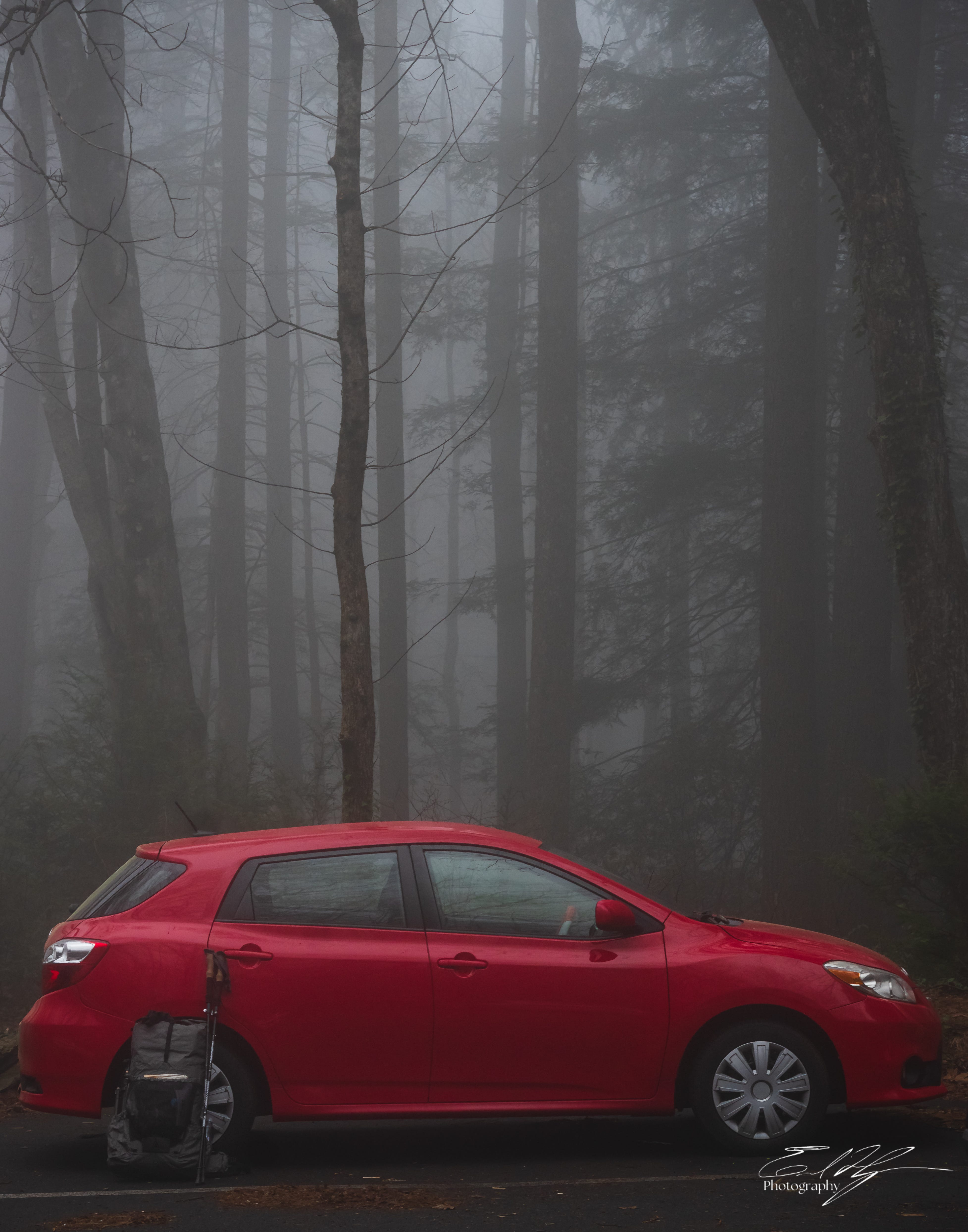
Clouds hang low this morning and I am inside of them as I park my little red Toyota at the trailhead parking lot. The air is still and damp. Silhouetted branches in the mist look otherworldly. Adding to the strangeness of this scene, somewhere hidden in the rhododendron thickets a rooster crows.
I shoulder my pack. The weight of it feels good after the long drive. Underfoot, the trail is soft and welcoming. It has been months since I have backpacked. Almost a year since my last long trail. My legs and lungs come alive as I begin the climb.
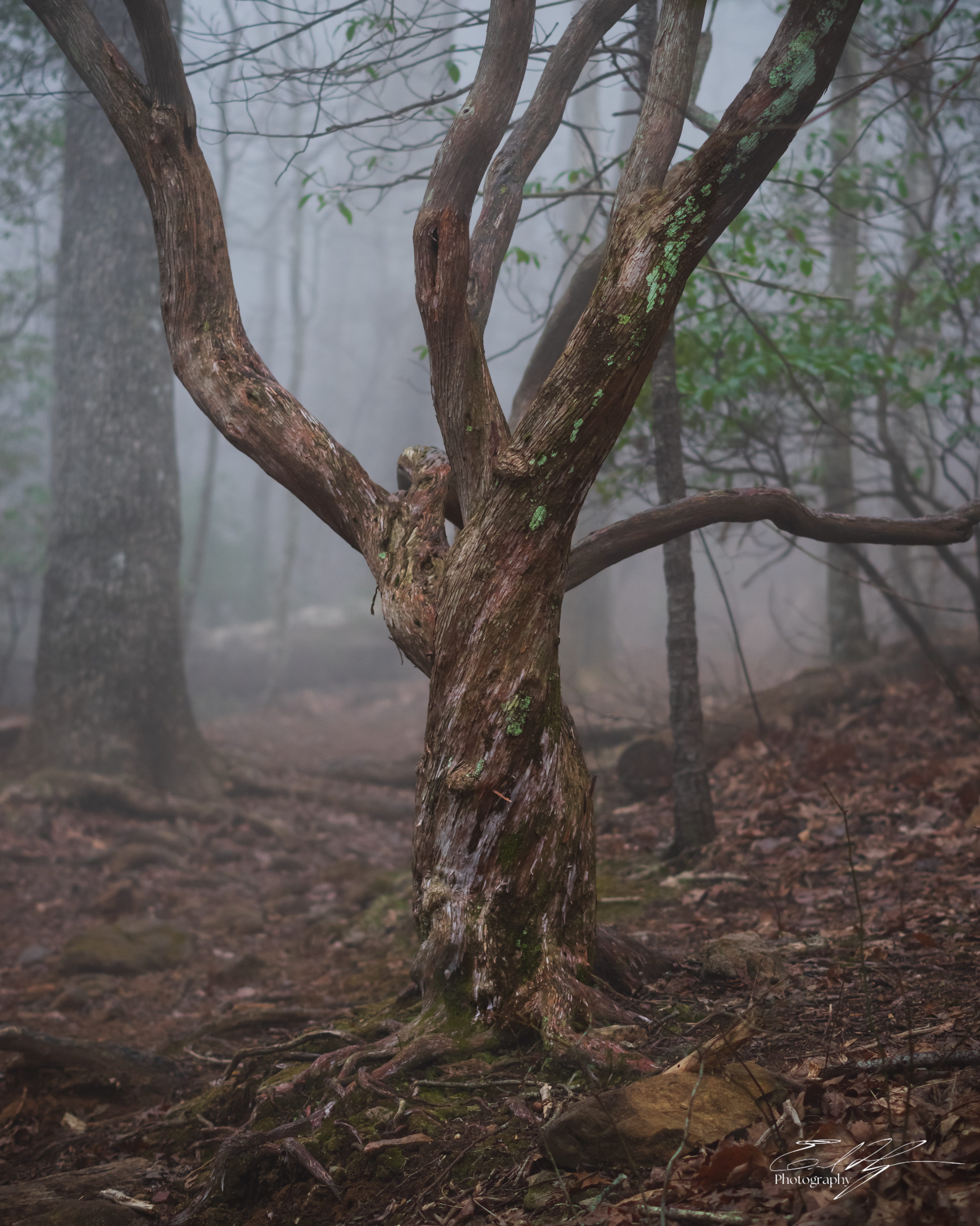
A short approach trail leads up from the parking lot. I move through the fog, surrounded by vague forms of twisted mountain laurel and the minimal suggestion of trees. A heavy scent of damp earth lingers.
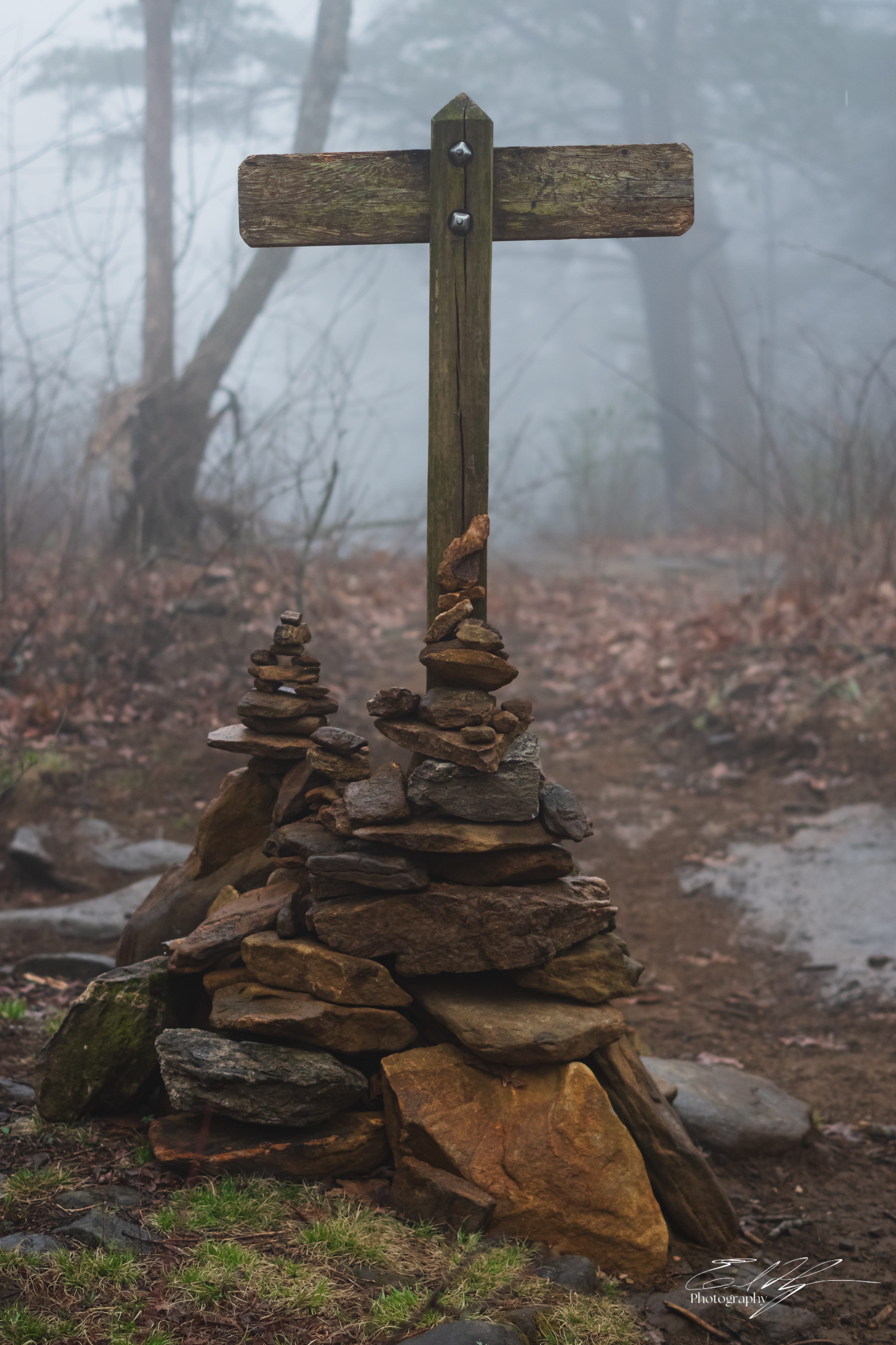
Soon, out of the fog on a ridge above a sign appears. It is familiar. I have hiked this stretch many times before. A right turn at the intersection and I am for a short while hiking south on the Appalachian Trail. It is the beginning of the steep ascent up Blood Mountain.


The trail becomes a worn path over rock and through tangled walls of green. Though the air is raw, the effort of the climb summons a sweat. My breathing becomes labored. Heaving. But I feel vibrant and alive.
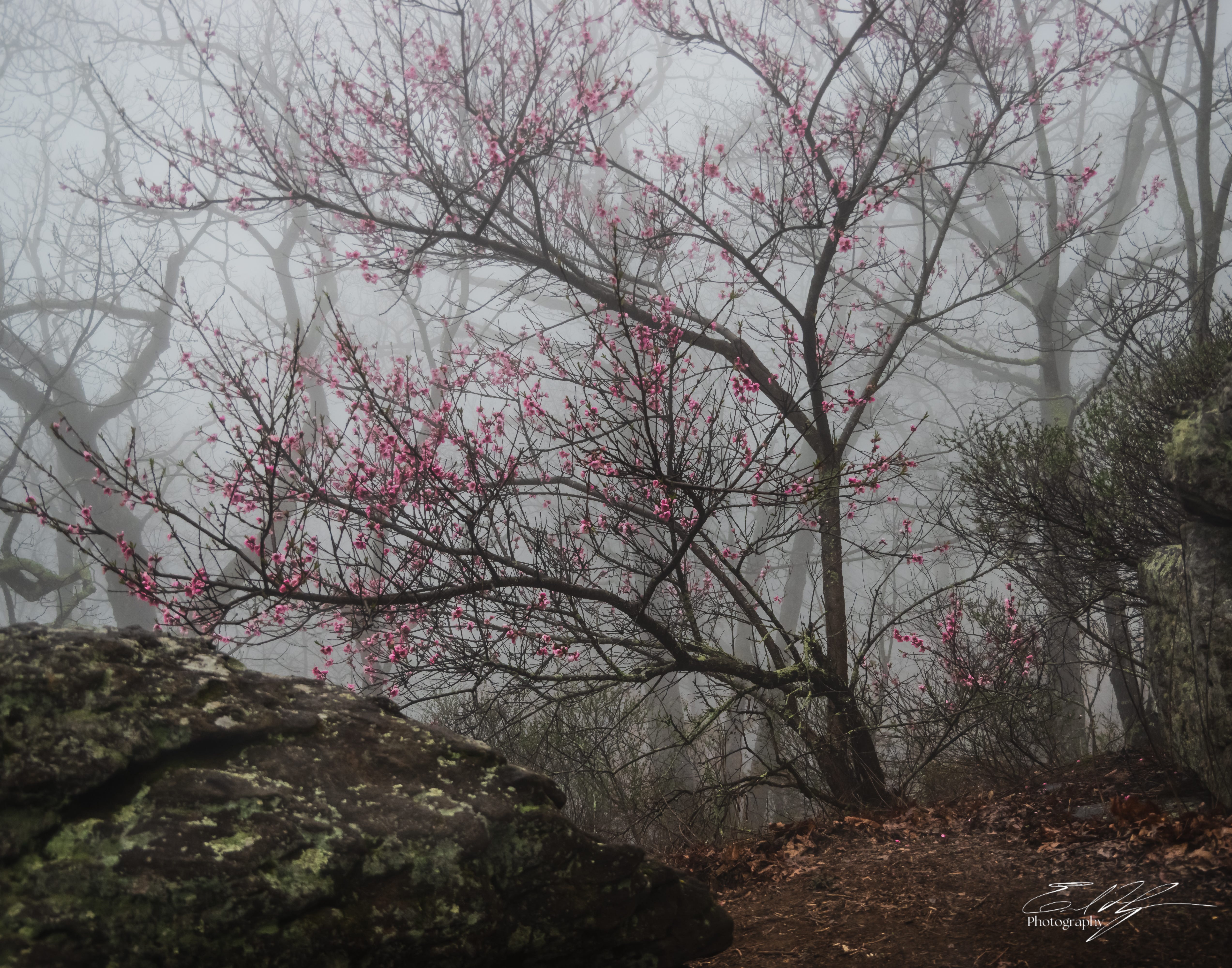
Dense fog is ever present around me. It is so ubiquitous, in fact, that my awareness loosens its grip of it and instead focuses on the sharper details of the branches, stones, and lichens all around. Small silent birds hop through the under story. The flora shows hints of green and some blooms, subtly whispering of the coming spring.


I pass some thru hikers. I can tell by the green AT tags that adorn their packs. They are heading north while I continue south to the top of Blood Mountain. This is the time of year when northbound (NOBO) thru hikers begin their epic trek from Georgia to Maine.
I purposefully planned to hike The Georgia Loop with NOBO thru hiking on the AT in mind. Not for myself, of course. At least not right now. I am still tied to my career in a way that will not allow it. But the second half of the Georgia Loop will have me NOBO on the AT for a couple of days. Its a fraction of the experience, but maybe I can get just a taste of it. Maybe I can meet some thru hikers along the way.
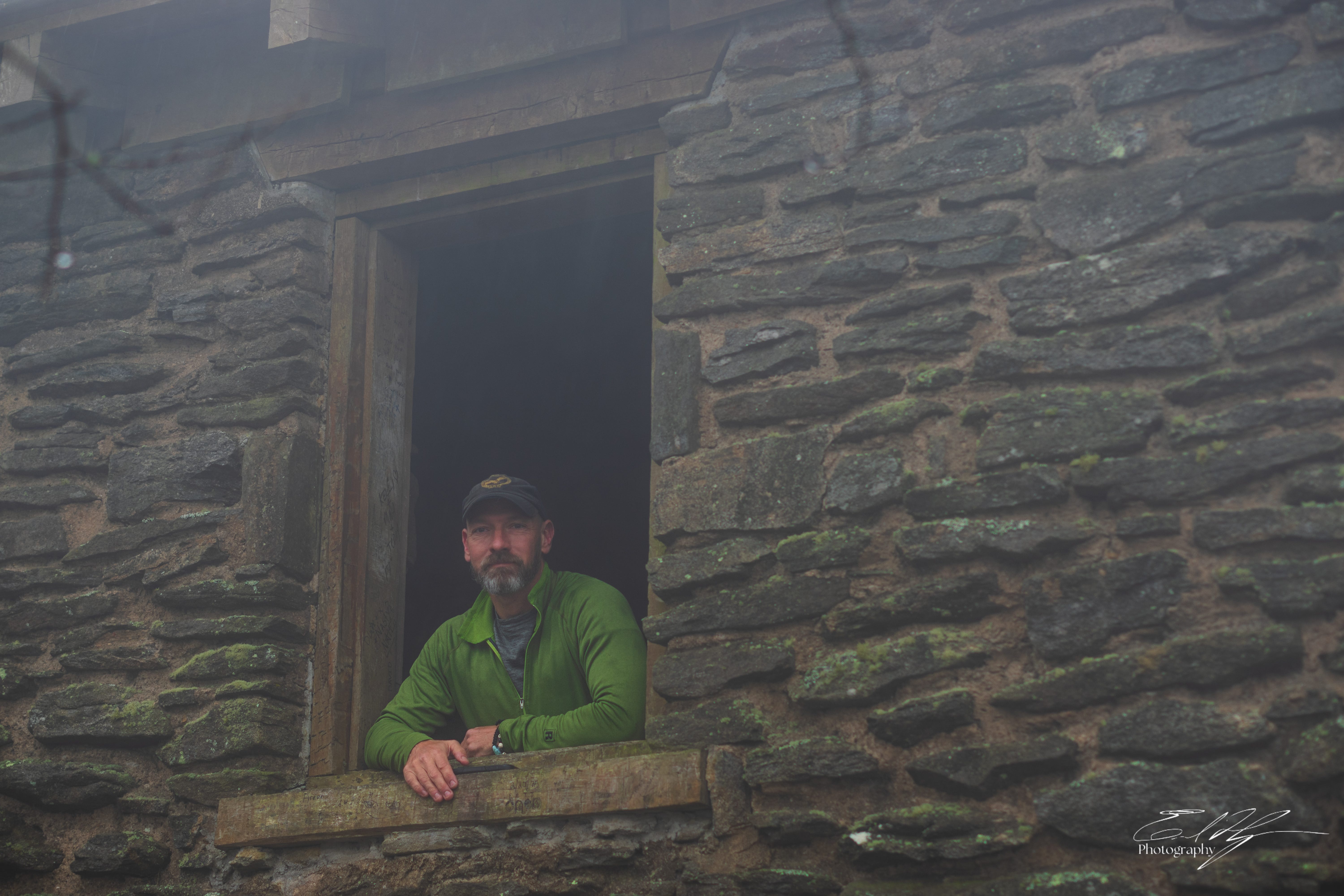
It is not long before I reach the summit of Blood Mountain and the stone shelter at its peak. This ancient looking structure was built in the 1930’s by the Civilian Conservation Corps.
I hoped to spend time here photographing details of the building. However, just as I arrive, so does a large group of men backpacking north. They don’t look like thru hikers. Many seem unfamiliar with backpacking or hiking in general, but they are led by a man who knows what he is doing. They’re friendly, just numerous. Fortunately they do not stay long.
After the group clears out I step into the shelter. One more thin young guy remains inside and I learn that he is thru hiking the AT. We talk for a while as his girlfriend catches up, but then it is time to go. He heads north as I start south down the other side of the mountain.
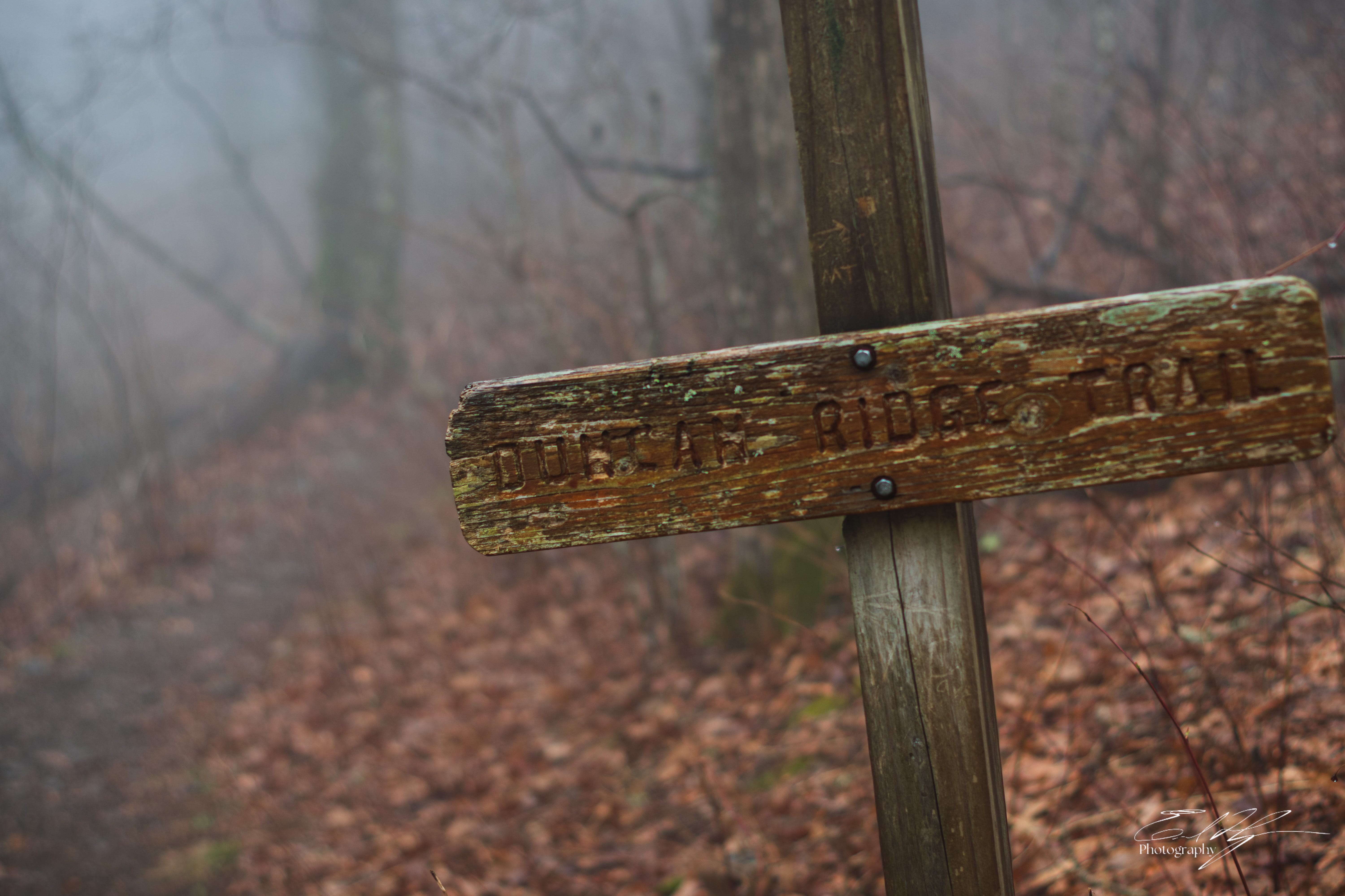
It is on this side of Blood Mountain that I leave the Appalachian Trail behind for now. The Duncan Ridge Trail begins here, generally following a bowed course to the northwest.
From Blood Mountain I descend into Slaughter Gap and then ascend the flanks of Slaughter Mountain. What curious twist of fate has led me into terrain named after such violence? Although historical details are scarce, both Blood and Slaughter mountains were named after a fierce battle between the Cherokee and Creek Indian tribes that took place here. The story of humanity has been delineated by conflict since its beginnings.
The wind blows strongly through the gap and on this side of Slaughter. Visible wisps of mist race silently through the uncanny forest setting. They swirl and writhe in unsettled, form-shifting discord all around me. I walk on steadily in deferential silence, encircled by ghosts.


The Duncan Ridge Trail is easy to follow, but very different from the AT. A smaller trail, it stumbles over rocks and roots. It powers directly up ridges and peaks without the use of switchbacks, then drops steeply into the gaps beyond.
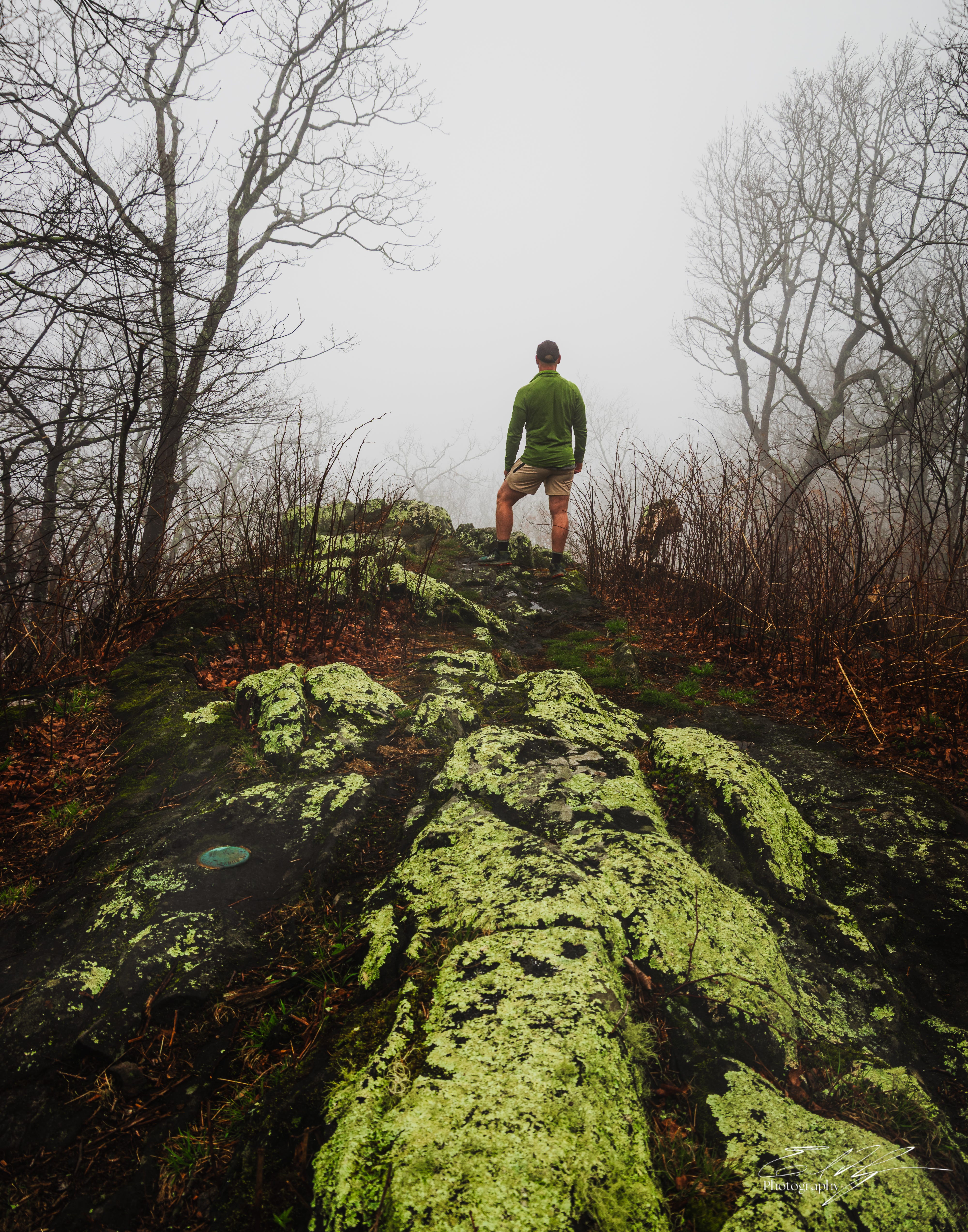
Around Wildcat Knob and then past Wildcat Gap, the trail takes me on a long climb up a ridge to the peak of Coosa Bald. This is the third 4000ft peak I have climbed today, after Blood and Slaughter Mountains. Perhaps at one time Coosa was a true bald, but that is no longer the case. It is now capped with trees, but does have a small rocky prominence at the top. On this day instead of a view I stand looking into the void.
I break briefly for lunch on top of Coosa. But soon, it is time to move again. Until now I had been taking my time on the trail, but I still have miles to cover to reach my destination for the night.
On the ridge lines the elevation levels somewhat, allowing me to stride out and push the pace. It is steady, tough work and my legs feel fatigued. Water is becoming a concern. I have enough, but sources are few and far between. I fill up when I can, but try to avoid the weight of carrying much with me as I walk.
I pass through West Wildcat Gap and then up and over West Wildcat Knob. Movement in the forest ahead. Two women runners pass by me wearing runners’ vests, but no packs. A little while later a third comes by. I come to Mulky Gap and encounter two male runners. Now, I have to ask.
“Are you guys racing or training?”
“Training,” they reply.
The women are part of their group. They are here from Indiana, in preparation for a future ultra marathon race along the Duncan Ridge Trail. We talk for a few more minutes, but then head on in opposite directions.
Mulky Gap is my last good water source for a long while. I fill up with as much as I can carry, in preparation for having enough for camp tonight and in the morning. Three liters adds quite a bit of weight and my progress slows. Nearby in the gloomy woods I hear the whinney of woodpeckers flitting in the trees. It sounds like they are laughing at my terrestrial-bound burden.
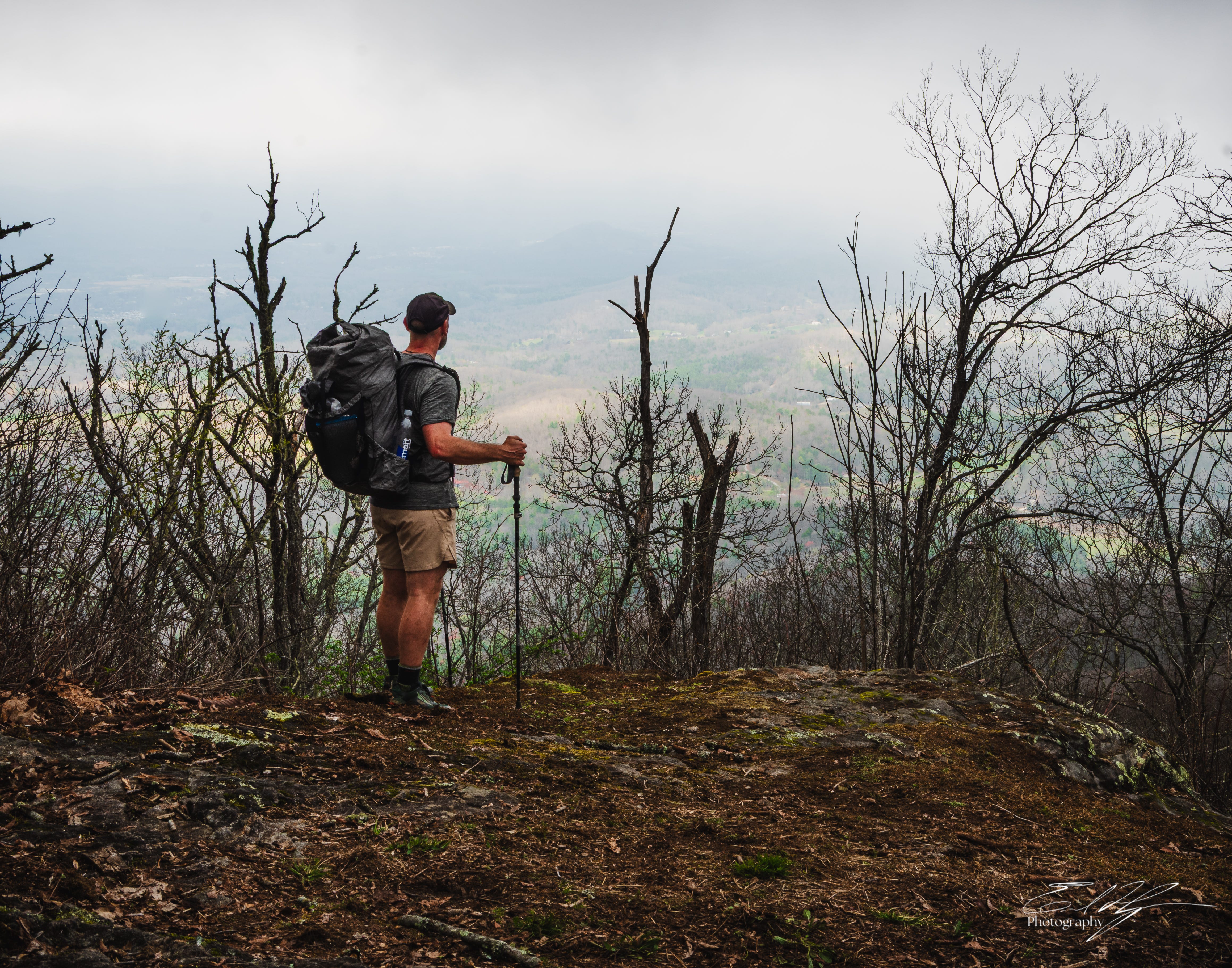
There is a big climb after Mulky to the top of Akin Mountain. From there it traverses over to the nearby Clements Mountain. The afternoon is growing very late.
I’m not sure whether the clouds are lifting or if the lower elevation compared to earlier today puts me more underneath them. Either way, I almost gain a view from Clements. I see a patchwork quilt of light on the fields in the valley below, but the sights are always filtered through a dense tangled net of branches.
Head down, I push myself on. Daylight grows dim. I need to make it at least to the 15 mile mark for the day. An upcoming campsite at Fish Gap was described online as less than ideal. I would like to may it beyond there, but there aren’t any other reliable campsites within a reasonable distance.
Movement uphill ahead of me. My head snaps up and eyes focus in the fog. I see dark brown fur as an animal springs off of the trail to my left and vanishes. My first thought is was that a bear? No, too small. A cub? No. It would have been less than knee high on me. I mentally review the vision of it. I am fairly certain it was a fox. I examine the ground where I last saw it, but there is no evidence that it ever existed. Just another ghost.
As the trail approaches Fish Gap there is a small ridge to my left, after which the terrain slopes steeply downhill. Still shaking off the brief animal encounter, I hear a horrific shriek from just over the ridge top- REEEEEE! For a fraction of a moment that feels like an eternity, my mind draws a complete blank as to what on earth that is.
First thought- the thing is running away from me down the slope. Second thought- that sounded like a pig. A wild hog. That was undoubtedly the sound of a wild hog. I stand still for several minutes more, but it is gone.


It is late when I walk into Fish Gap. A dirt road makes a wide cul-de-sac dead end here and a fire ring sits directly in the middle of it. A large mound of bear scat nearby is a bit disconcerting, but it appears pretty old. Fog is settling in thick again.
I pitch my tent off to the side on an old unused logging road that intersects here and prepare my food by the fire ring. The mist in the tree line swirls like so many gossamer specters looking on and makes me wonder. Can ancient places like Slaughter Gap really hold onto their ghosts? Or perhaps ghosts are little more than memories, and haunt us only insofar as we carry them with us when we’d rather not. If that’s the case, I choose to recognize those memories, good and bad, and use them to craft my own psyche. I choose to walk with those ghosts.
Darkness has fallen and it is beginning to drizzle. I lay down in the tent and am instantly asleep.


So that was day 1 of The Georgia Loop! Off to a wild start! What do you guys think? The photos are intended to be narrative in nature, with some establishing shots of the scenes, a few of the main character (me!), and some details from along the way. How’d I do?
Continue reading Day 2 of the Georgia Loop HERE
Interested in more photography and stories of the great state of Georgia? Find them HERE
Field Notes is a value-for-value proposition. If you get value from it, please consider contributing back by sharing, subscribing, or upgrading. Also, a one time contribution tip of any amount goes a long way. We’ll call that Trail Magic. Your support goes directly towards the food, supplies, or gear necessary for the photography, writing, and adventures that I share-


Erik, I really enjoyed this. Your writing is fantastic while the photos added to the experience. I loved all of the photos but the one of your car struck me because of the contrast of color. The vibrant red against the backdrop of grays was really powerful. Well done.
Great narrative, and I love the atmospheric fog. The photo contrasting your red car with the dark woods is really cool. Looking forward to the continuation!